

Road Atlas for the Total Solar Eclipse of 2024 - Color Edition [By Espenak]
This item is discontinued by the manufacturer and is no longer available.
Stock count is accurate & shown in real time.
- This item is out of stock.
- Sign up for back-in-stock alerts to be notified when this item becomes available (account login required).
- This item is out of stock.
- Sign up for back-in-stock alerts to be notified when this item becomes available (account login required).
Title: Road Atlas for the Total Solar Eclipse of 2024 - Color Edition
Author(s): Fred Espenak
Other Info: 8.5" by 11", 50 pages, Paperback, 0.88 lb item wt.
On Monday, April 8, 2024, a total eclipse of the Sun will be visible from parts of the United States and Canada. Although a partial eclipse will be seen from all of North America, the total phase in which the Moon completely covers the Sun (known as totality) will only be seen from within the 120-mile-wide path of the Moon’s umbral shadow as it sweeps cross Mexico, the United States (Texas, Oklahoma, Arkansas, Missouri, Tennessee, Kentucky, Illinois, Indiana, Ohio, Michigan, Pennsylvania, New York, Vermont, New Hampshire, and Maine), and Canada (Ontario, Quebec, New Brunswick, Prince Edward Island, Nova Scotia and Newfoundland).
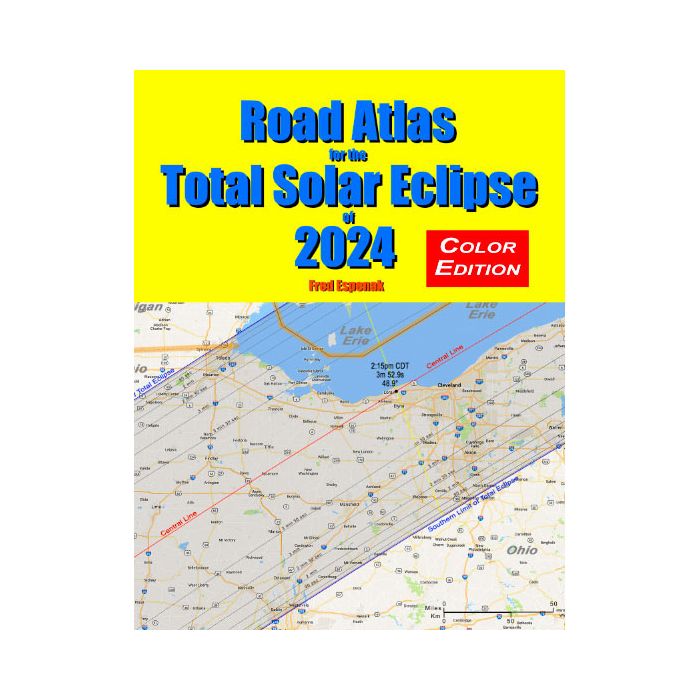
Road Atlas for the Total Solar Eclipse of 2024 contains a comprehensive series of 26 maps of the path of totality across Mexico, the USA and Canada. The large scale (1 inch ≈ 22 miles) shows both major and minor roads, towns and cities, rivers, lakes, parks, national forests, wilderness areas and mountain ranges.
The path of totality on each map is depicted as a lightly shaded region with the northern and southern limits clearly identified. The total eclipse can be seen only inside this path. The closer one gets to the central line of the path, the longer the total eclipse lasts. Gray lines inside the path mark the duration of the total eclipse in 30 second steps. This makes it easy to estimate the duration of totality from any location in the eclipse path.
Yellow lines running across the path at 5-minute intervals indicate the local time of mid-eclipse. Where they cross the central line (plotted in red) the local time, central line duration of totality and the Sun's altitude are labeled. This eliminates the need to look these details up on a table.
Armed with this atlas and the latest weather forecasts, the road warrior is ready to chase totality no matter where it takes him/her along the entire path. This mobile strategy offers the highest probability of witnessing the spectacular 2024 total eclipse in clear skies.
Other Information
- Country of Manufacture: United States
Title: Road Atlas for the Total Solar Eclipse of 2024 - Color Edition
Author(s): Fred Espenak
Other Info: 8.5" by 11", 50 pages, Paperback, 0.88 lb item wt.
On Monday, April 8, 2024, a total eclipse of the Sun will be visible from parts of the United States and Canada. Although a partial eclipse will be seen from all of North America, the total phase in which the Moon completely covers the Sun (known as totality) will only be seen from within the 120-mile-wide path of the Moon’s umbral shadow as it sweeps cross Mexico, the United States (Texas, Oklahoma, Arkansas, Missouri, Tennessee, Kentucky, Illinois, Indiana, Ohio, Michigan, Pennsylvania, New York, Vermont, New Hampshire, and Maine), and Canada (Ontario, Quebec, New Brunswick, Prince Edward Island, Nova Scotia and Newfoundland).
Road Atlas for the Total Solar Eclipse of 2024 contains a comprehensive series of 26 maps of the path of totality across Mexico, the USA and Canada. The large scale (1 inch ≈ 22 miles) shows both major and minor roads, towns and cities, rivers, lakes, parks, national forests, wilderness areas and mountain ranges.
The path of totality on each map is depicted as a lightly shaded region with the northern and southern limits clearly identified. The total eclipse can be seen only inside this path. The closer one gets to the central line of the path, the longer the total eclipse lasts. Gray lines inside the path mark the duration of the total eclipse in 30 second steps. This makes it easy to estimate the duration of totality from any location in the eclipse path.
Yellow lines running across the path at 5-minute intervals indicate the local time of mid-eclipse. Where they cross the central line (plotted in red) the local time, central line duration of totality and the Sun's altitude are labeled. This eliminates the need to look these details up on a table.
Armed with this atlas and the latest weather forecasts, the road warrior is ready to chase totality no matter where it takes him/her along the entire path. This mobile strategy offers the highest probability of witnessing the spectacular 2024 total eclipse in clear skies.
Title: Road Atlas for the Total Solar Eclipse of 2024 - Color Edition
Author(s): Fred Espenak
Other Info: 8.5" by 11", 50 pages, Paperback, 0.88 lb item wt.
On Monday, April 8, 2024, a total eclipse of the Sun will be visible from parts of the United States and Canada. Although a partial eclipse will be seen from all of North America, the total phase in which the Moon completely covers the Sun (known as totality) will only be seen from within the 120-mile-wide path of the Moon’s umbral shadow as it sweeps cross Mexico, the United States (Texas, Oklahoma, Arkansas, Missouri, Tennessee, Kentucky, Illinois, Indiana, Ohio, Michigan, Pennsylvania, New York, Vermont, New Hampshire, and Maine), and Canada (Ontario, Quebec, New Brunswick, Prince Edward Island, Nova Scotia and Newfoundland).
Road Atlas for the Total Solar Eclipse of 2024 contains a comprehensive series of 26 maps of the path of totality across Mexico, the USA and Canada. The large scale (1 inch ≈ 22 miles) shows both major and minor roads, towns and cities, rivers, lakes, parks, national forests, wilderness areas and mountain ranges.
The path of totality on each map is depicted as a lightly shaded region with the northern and southern limits clearly identified. The total eclipse can be seen only inside this path. The closer one gets to the central line of the path, the longer the total eclipse lasts. Gray lines inside the path mark the duration of the total eclipse in 30 second steps. This makes it easy to estimate the duration of totality from any location in the eclipse path.
Yellow lines running across the path at 5-minute intervals indicate the local time of mid-eclipse. Where they cross the central line (plotted in red) the local time, central line duration of totality and the Sun's altitude are labeled. This eliminates the need to look these details up on a table.
Armed with this atlas and the latest weather forecasts, the road warrior is ready to chase totality no matter where it takes him/her along the entire path. This mobile strategy offers the highest probability of witnessing the spectacular 2024 total eclipse in clear skies.
Other Information
- Country of Manufacture: United States